
In Townsville on a few days’ holiday I was determined to get to Magnetic Island where I’d last visited in 2011. The island looked tantalisingly close from our apartment balcony just off the Strand but the bay was breezy on the day we arrived.

The wind died down the following morning when we went to the nearby Sealink terminal to catch the passenger ferry with Mt Stuart glistening in the morning sunshine. More people got off the morning ferry from the island than were going out. Around 2500 people live there and it is an easy commute to the mainland for work and school.

It seemed to be only tourists heading the other way. We set off from the harbour for the speedy 20 minute trip 8km across Cleveland Bay to the island.

We soon arrive in Nelly Bay. Half of the island’s permanent population live here near the ferry terminal. The bay was reputedly named after Nelly Butler, daughter of Henry Butler who arrived on the island in 1877. Butler burned the coral lime and established the first boat service with the sailing boat “Hepzibah” (named for the Biblical wife of Hezekiah, King of Judah).

There is an hourly bus service on the island but we set off on foot towards Geoffrey Bay on Gabul Way which links Nelly Bay with Arcadia. The traditional people of Magnetic Island are the Wulgurukuba “canoe people”. About 200 people lived here in 1770 when Cook named the island because he mistakenly thought the island was interfering with the ship’s compass. In the Wulgurukuba dreaming story of how the region was created, Gabul was a giant carpet python who carved up the landscape from the Herbert River to Townsville. Geoffrey Bay is where scientists discovered in 1981 that many coral species reproduce on the same few nights each year.

The Gabul Walk ends at Arcadia and we had to take our chances on a narrow, busy and winding road up the hill towards the Forts Walk. Our relaxing day was starting to turn stressful especially at the corners where we had to be careful to avoid fast moving traffic. Later I found a walkway back but it wasn’t well signposted and even then did not completely cover the distance. Townsville Council need to address this for people who prefer to walk or cycle as the current system assumes everyone drives or catches the bus.

We relax again once we get to the Forts Walk and enjoy the calming view to Arthur Bay.

The walk is named for the Second World War forts complex built on the island. The command post was situated high on the island so it had the first view of any enemy activity directed towards the mainland.

These green fruits with yellow flower are from the Caribbean-native kapok tree (cochlospermum gillivraei). The tree is three to 12 metres high and deciduous in the dry season. The bright yellow flowers appear before the new leaves. The fruit is medicinal as an oral rinse.

Another newcomer on the island are the koalas. They were introduced to the island in the 1930s to protect them from threats on the mainland. They have thrived and there are almost 1000 of them. By day koalas rest in the eucalypt branches, feeding on leaves from late afternoon onwards. The nutrient-poor diet means koalas stay motionless for up to 20 hours a day.

It was hard work building this 2km track in 1942. Army engineers blasted a route to the top using explosives before a local Main Roads crew constructed it using jackhammers and a dozer. Along the track are “whoa boys” (bumps in the road) which divert the water off the track while the rock capping resists erosion in seasonal downpours.

The military camp existed from 1943 to the end of the war. There were separate quarters for men and women, and officers and other ranks. After the road was built in 1942, battery personnel were redeployed from Fort Lytton in Brisbane and placed in tents until the buildings were ready. There was a water pump and sewerage system with power supplied by five petrol generators. Commanding Officer Major Arnold Nicolle said they saw little action “apart from the occasional donnybrook with the 50 Americans stationed on the island”. Above is the remains of the mess which had a fireplace and support for a 44-gallon drum. Wine bottles marked “1943” and beer bottles were discovered in a nearby rocky hiding spot.

Critical to the fort’s operation were the two US Army 155mm guns, each weighing 10 tonnes, sited at separate emplacements. The gun pallets were hauled up the beach over logs and towed into position by tractors.

The artillery command post controlled operations including searchlights and radar. It housed a depression range finder and a long telescope to measure the range of a target. Plotters from the Australian Women’s Army Service used the readings to calculate details and communicate orders to battery command on Castle Hill on the mainland. During the war the building was concealed by netting and concrete rocks.
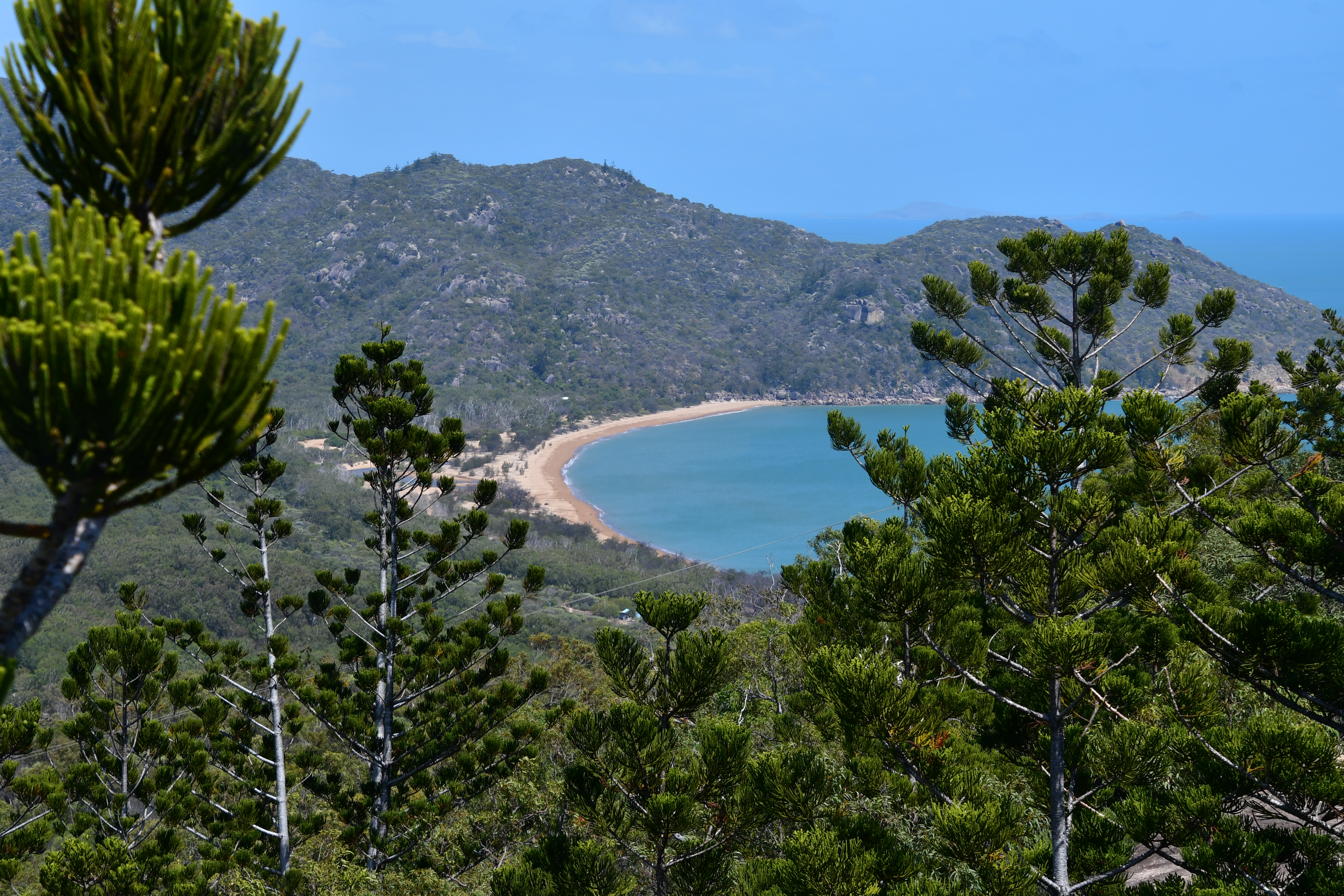
From the top we get a glimpse of Horseshoe Bay and see why it got its name. Horseshoe Bay is a popular tourist spot on the island with watersports and cafes and bars by the beach.

Near the command post is a second tower, this one a three-storey signal station. Run by the Australian Navy, it used light and flag communications. The big signal light was visible from Palm Island, 60km north. Standing 230m above sea level it had a 300 degree ocean view and could monitor all shipping in Cleveland Bay. Challenged ships had to respond with the code of the day. Nowadays the roof houses UHF and VHF radio repeaters.

Florence Bay is another secluded bay on the east coast of the island accessible by one of many walks in the area.

The view back to the command post from the signal station with Cape Cleveland in the background.

Mount Cook rises 493 metres out of the Coral Sea and is the highest point on the Magnetic Island. On June 6, 1770, Cook wrote in his journal: This bay which I named Cleveland Bay appear’d to be about 5 or 6 Miles in extent every way. the East point I named Cape Cleveland and the West Barren Head. Magnetical head or Isle as it had had much the appearence of an Island and the Compass did not travis well when near it. They are both tolerable high and so is the Mainland within them and the whole appear’d to have the most rugged, rocky and barren Surface of any we have yet seen however it is not without inhabitants as we saw smooks in several place in the bottom of the Bay.”

It was time for me to head down to the bay for a swim at Alma Bay near Arcadia. There is healthy fringing reef that follows along the rocks on either side of the bay with a large fish population that can be seen while snorkeling.

I decided on a walk across the top of the island to get back to the ferry at Nelly Bay. At 6.5km and a rough surface on a hot afternoon, it was a bit of a route march especially as I only had an hour and a half to make the ferry.

The walk was mostly in the trees but there was the occasionally view of the shoreline through the foliage. We regretted we only went for a day trip. Next time we’ll spend more time on the island.


