In my previous working life in Brisbane two decades ago, I cycled everywhere. This was an era when most motorists regarded cyclists as slow-moving inconveniences and my mere presence on the road was often enough to anger many. Things have improved since then and though the city remains woefully car dependent, more people are cycling or taking other forms of active transport, road conditions are better, and fewer motorists regard you as road kill. I was reminded of that on Tuesday which was my birthday, and as many people told me, a significant one at that. I decided that turning 60 was a great excuse to cycle the Brisbane river loop, something I used to do every week but hadn’t done since 2009. So I was out early on a chilly winter morning in the supposed sub-tropics.
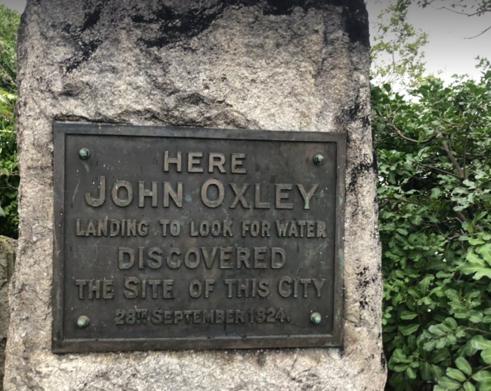
The loop follows a well-worn path familiar to the Toorbul and Jagera people who lived for millennia on either side of the magnificent river. Near the Herschel St bikeway entrance is a monument to the founder of the European settlement, John Oxley, who came by in 1824. As I’ve explored before, his landing spot was a few kilometres upstream of this neglected North Quays monument. This was Oxley’s second visit to Brisbane. A year earlier he had found the river as well as two European castaways, a story told by Oxley’s supercargo, Waterford man John Uniacke.
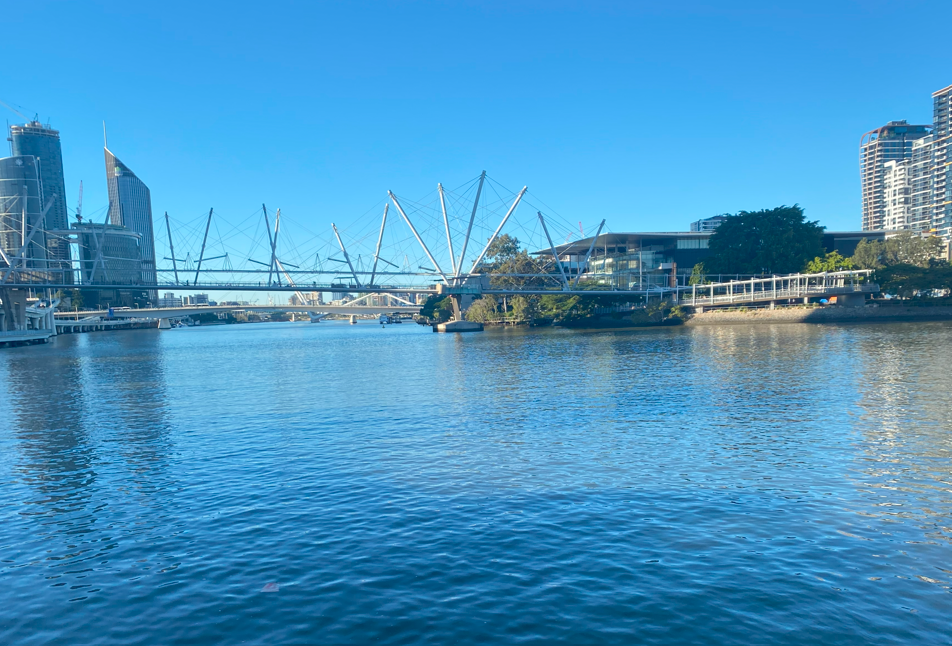
In early settlement times, ferries transported passengers and goods across the Brisbane River. The first “Brisbane Bridge” was built in 1865 where the Victoria Bridge now stands but lasted only two years. On November 16, 1867 the bridge collapsed, due a combination of a high tide placing pressure on weakened wooden piles and a large coach crossing the bridge. Jubilant ferry companies doubled prices as they regained a monopoly for another six years. The first Victoria Bridge opened in 1874 and lasted until February 1893 when 900mm of rain caused flood debris to collapse a section of it. The second Victoria Bridge opened in 1896 and survived for 73 years until it was replaced by the third and current Victoria Bridge (rear of image above). The Kurilpa pedestrian and bicycle bridge (foreground) was not added until 2009, so is a new addition from my looping days.
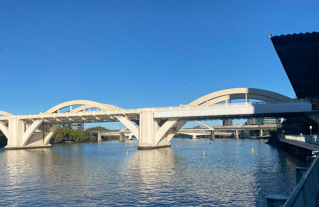
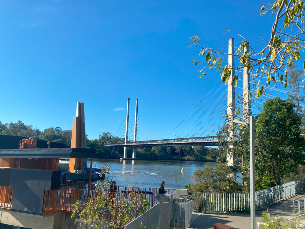
The Victoria Bridge was Brisbane’s only crossing until the 1930s when it was joined by two depression-era projects, the Story Bridge and the one above, the art deco Grey St Bridge, later renamed for Brisbane’s first Lord Mayor William Jolly. Behind it is the Merivale rail bridge opened in 1978 (before that trains crossed the river at Indooroopilly) and behind that is the tolled Go Between road bridge, named for the great Brisbane band the Go Betweens. It was opened in 2010 and another addition to the landscape since last I looped.
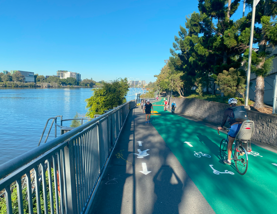
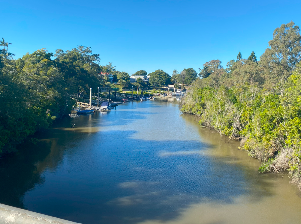
I set off towards Toowong. The path is busy with peak hour traffic and one useful recent addition is a separator between pedestrian and active transport modes. Much more needs to be done in Brisbane and other Australian cities to accept the fact that three modes of transport go at different speeds: pedestrians around 5kph, bikes and scooters around 20kph and vehicles at 50kph or more. Most roads should reflect that three-way usage but that means taking space from cars, which governments and councils remain reluctant to do.
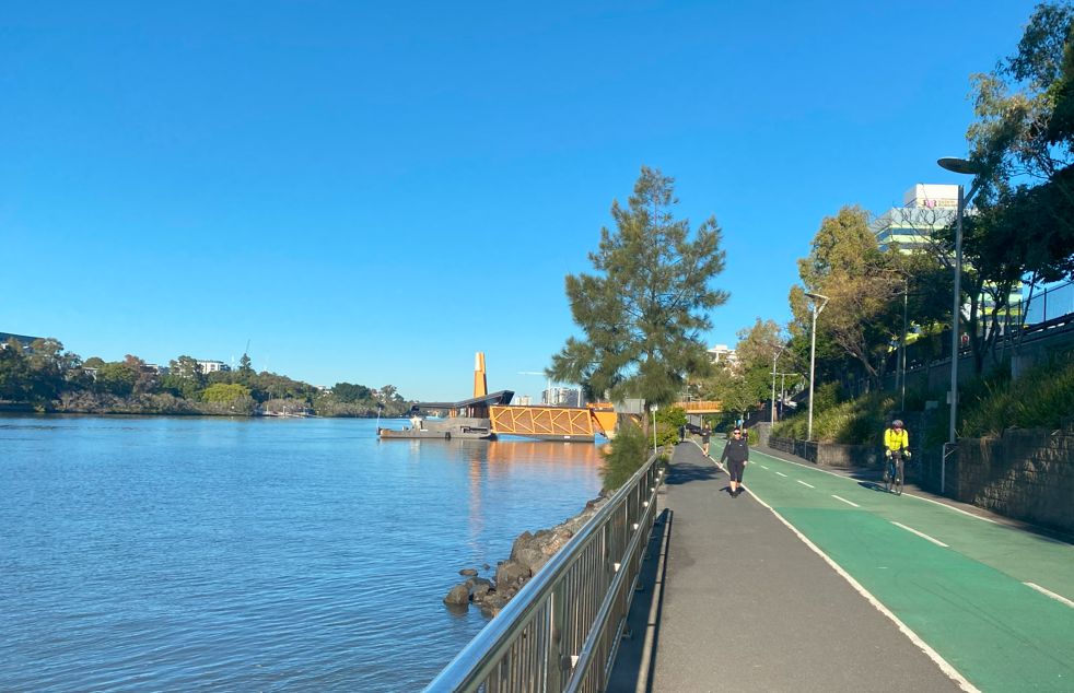
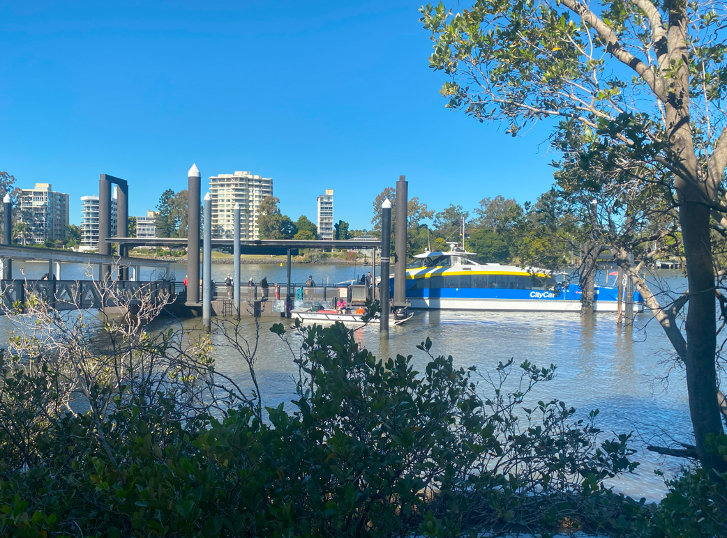
The Milton ferry terminal is another addition, barely 10 years old. It always seemed wrong to me that the CityCat ran from West End directly to the city without intermediate stops and this is one of two new stops to address the problem. It is a handy public transport option for the Park Road restaurant precinct.

Also in Milton is the entrance to the former Western Creek, now pushed underground into a network of stormwater drains, and partially converted into a large concrete canal. This is where Oxley landed to begin Brisbane’s settlement in 1824. In my day it was the site of the Drift Cafe until the 2011 floods when, well, it drifted.
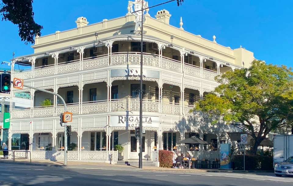
Beyond that is the second new ferry terminal, the Regatta, named for the magnificent pub across the road on Coronation Drive. The first wooden single-storey hotel was established here in 1874 and named for the regattas that took place outside the front door. In 1886 publican William Winterford built the current hotel reflecting Brisbane’s then-boom times. The clientele never quite matched Winterford’s vision and the hotel suffered badly in the 1890s depression and floods. The Regatta is thriving again but remains most famous for the 1965 incident when feminists Merle Thornton and Rosalie Bognor chained themselves to the public bar footrail in protest at Queensland’s men-only public bars. Though abused as “Communists”, their protest led to Queensland law changes in 1970. The pub named Merle’s Bar in Thornton’s honour in 2014.
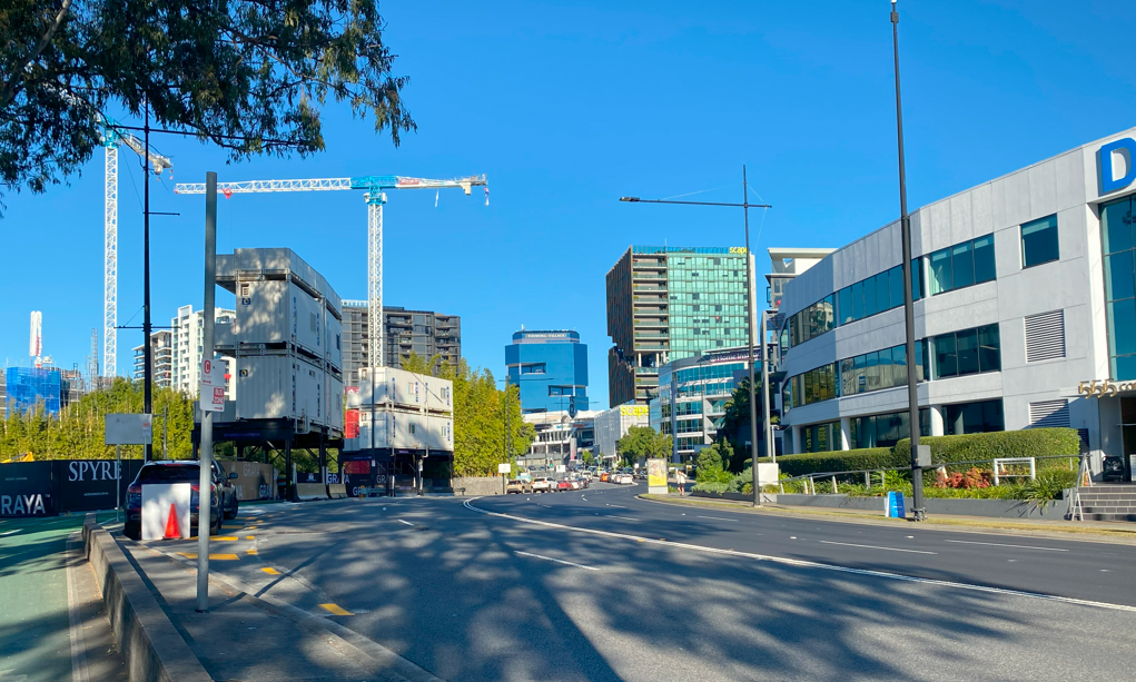
Toowong marks the end of the riverside Bicentennial Bikeway and it’s back streets from here to St Lucia. In the 1850s land was first auctioned in what became Toowong shire. Well known Queenslanders such as Robert Towns (after whom Townsville is named), government printer WC Bellbridge, and the Weinholt grazing family, whose son Arnold became a Queensland MP and won a Military Cross in the First World War, moved in and build grand houses. The opening of the railway station and Toowong cemetery in the 1870s cemented Toowong’s importance. The cranes in this photo testify that Toowong remains a strategic site of Brisbane’s future growth.
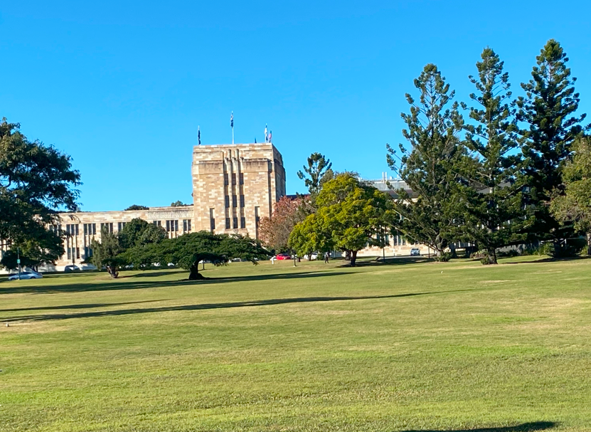
The Great Court and Forgan Smith Building are at the heart of the University of Queensland’s main campus at St Lucia. UQ was Queensland’s first university, established by a 1909 act of state parliament. It began in 1911 in Old Government House in George St but soon outgrew its city accommodation. It expanded at Victoria Park and then at St Lucia after the Mayne family bequest provided funds to purchase farmland. The Great Court was designed as “original in conception, monumental in design, and embodying the Australian spirit of art with English culture.” Labor premier William Forgan Smith laid the foundation stone in 1937. The centrepiece building named for him was the first constructed when the University relocated to St Lucia. The Great Court used multiple colours and shades of Helidon freestone resulting in a patchwork effect of purples, lavenders, creams and browns that looks especially attractive after rain. In the Second World War, the Forgan Smith Building headquartered the Allied Land Forces in the South West Pacific.
A newer addition is the Eleanor Schonell Bridge linking St Lucia and Dutton Park. This was Brisbane’s original green bridge and Australia’s first bridge exclusively designed for buses, cyclists and pedestrians. The bridge was named for South African-born scientist Eleanor Schonell who did pioneering work with children affected by cerebral palsy and dyslexia. She moved to Brisbane with Australian husband Fred who became UQ’s vice chancellor in the 1960s and is honoured by the name of St Lucia’s main thoroughfare. The bridge was opened in 2006 so I saw its construction and completion in the backend of my old riding days.
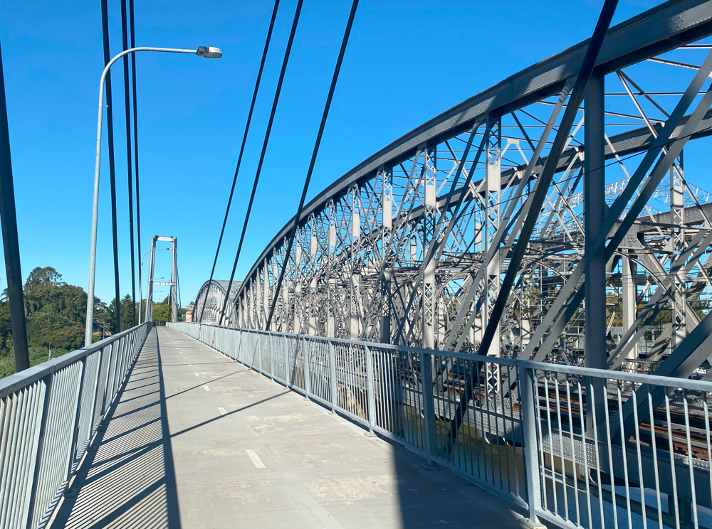
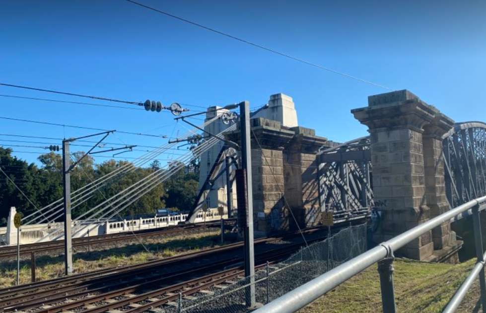
After the university, the loop comes away from the river due to the St Lucia and Indooroopilly golf courses. It crosses the river at Indooroopilly’s Jack Pesch pedestrian and cycle bridge. This bridge opened in 1998 and is appropriately named for a 1930s cycling champion who ran a Brisbane bicycle shop until the 1990s. The bridge sits parallel to three other bridges. Nearest is the Albert bridge, a heritage-listed rail bridge built to replace an 1876 bridge lost to the 1893 floods. Next is the second rail bridge, known simply as the Indooroopilly Rail Bridge. It is a truss bridge built in 1957 as part of the extension of the Ipswich line.
The fourth bridge is the heritage-listed Walter Taylor Bridge which carries vehicle traffic. English-born Walter Taylor was an engineering contractor and local resident, frustrated that there was no way to drive across to Chelmer. He proposed a suspension bridge which was built as yet another Depression-era project and opened in 1936. It was a toll bridge until the 1960s and its two towers housed residential accommodation, occupied by the tollkeepers’ families. It was called the Brisbane Toll Bridge until Taylor’s death in 1955 when renamed in his honour. The towers were occupied until 2010 when the last of the families moved out.
Crossing to the southside, river views return as I cycle past the backstreets of Chelmer. This area suffered badly in floods and was ground zero for Brisbane’s famous mud army, when 23,000 volunteers helped with the clean-up from the 2011 floods.
I crossed Pamphlet Bridge and looked down on Oxley Creek. The bridge and creek names are a nod to Oxley’s 1823 expedition. Thomas Pamphlet (sometimes Pamphlett) and fellow convict castaways had been blown off shore in a storm when sailing from Sydney to the Illawarra. They landed 800km north at Stradbroke Island and believing they were south of Sydney, headed north to the mainland. When they got to the mouth of a large river, they were forced inland to this creek, where they found a native canoe and crossed to the northside of the river and returned to the coast. Oxley found them at Bribie Island and followed their path in a whaleboat. He named the river for New South Wales governor Thomas Brisbane. The creek was later named for Oxley while the 1964 bridge was named for Pamphlet.
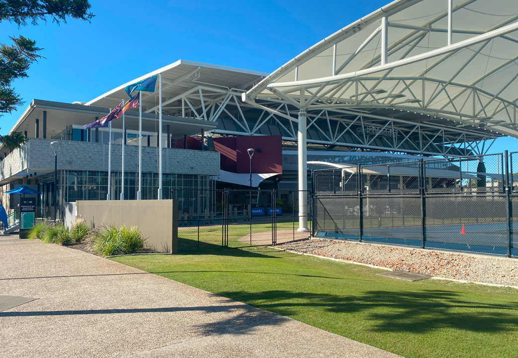
The imposing Queensland Tennis Centre, appropriately in Tennyson, is more infrastructure that did not exist in my old cycling days. A Queensland Lawn Tennis Association has existed since 1888 and a tennis centre was built at Frew Park, Milton in 1915. Here greats like Roy Emerson and Rod Laver learned their craft and it held Davis Cup ties until 1990 and tour events until 1994 when its crumbling wooden grandstands were declared unsafe. Tennis Queensland sold it to pay off debts in 1999. In 2005 the state government demolished Tennyson Power Station and built the Queensland Tennis Centre, an apartment complex and parklands on the site. The Tennis Centre opened in 2009 and now hosts the Brisbane International tournament and leisure tennis facilities. It has 23 courts, including all three Grand Slam surfaces — grass, clay and cushioned acrylic hard court.
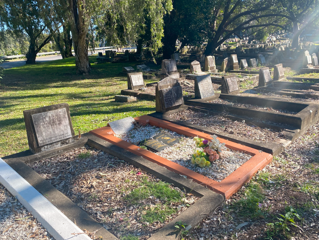
I stopped on the Brisbane Corso for a coffee before passing an older slice of Brisbane near the eastern approach to Eleanor Schonell Bridge. South Brisbane cemetery, also called Dutton Park cemetery, was established in 1866 making it older than Toowong and Lutwyche cemeteries (Milton and Nundah cemeteries are older still but have been built over). Its first burial was in 1870, a year before Toowong. Dutton Park was originally mainly gazetted as parklands but its housing population increased after Boggo Junction railway station opened in 1884 and a horse-drawn bus service to the city began in 1890. The road and railway helped provide access for funerals. The cemetery has been full since the 1960s though family burials still continue. Among those buried here is Ernest Austin, the last Queenslander to be hanged, at nearby Boggo Road Gaol.
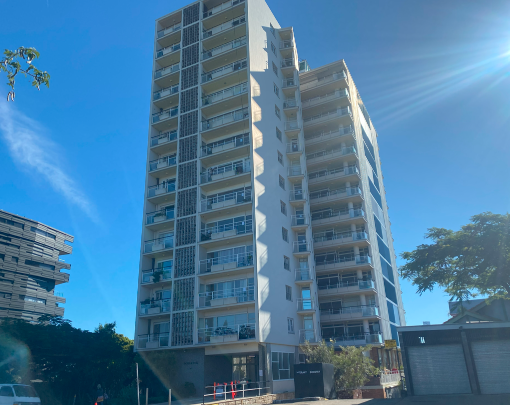
Past the cemetery is the steep climb up T.J. Doyle Memorial Drive and then up Gladstone Rd before turning into Dornoch Terrace in Highgate Hill. Here is the Torbreck building, Queensland’s first highrise. The building was constructed from 1957-60 and its name recognises the timber cottage called Torbreck that previously occupied the site. Media interest was intense on opening and the property was oversubscribed. The two interlocking soft modernist buildings (one 18 storeys, the other eight) with 150 apartments offer fantastic views to the city and Mt Cootha in one direction and the Scenic Rim mountains in the other. It was heritage listed in 1999 as the “first company-titled multi-storeyed home unit development erected in Queensland based on 1950s North American models.”
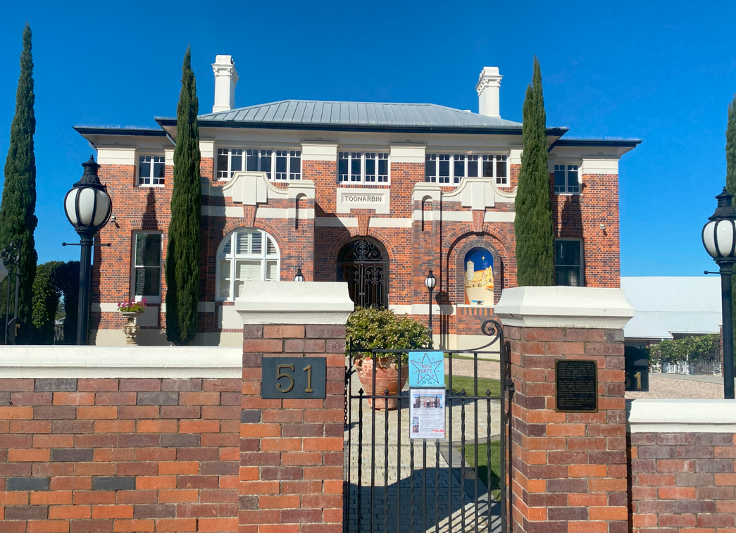
Further down Dornoch Tce is the two-storey mansion Toonarbin, built in the late 1860s by Dubliners Henry and Mary O’Reilly. The O’Reillys made their money in shipping and built this house on a secluded bushy property, which the previous owner called Toonarbin from Henry Kingsley’s 1859 novel Geoffrey Hamlyn, partially set on the fictional Toonarbin and Baroona stations. Henry O’Reilly died in 1876 and was buried at South Brisbane Cemetery, but the family lived here until 1926 when it was purchased by the Catholic Church. Archbishop Duhig converted Toonarbin to a convent for the Sisters of Mercy and built the outer brick walls. It operated as a convent until 1995 and remained vacant for 12 years until a private owner bought it. By 2013 it was meticulously restored to past glory.
I freewheeled down Dornoch Tce and then Hoogly St back to the river, arriving at Orleigh Park just as a CityCat entered West End ferry terminal heading to St Lucia. Before European arrival, this area was covered with thick rainforest. This was swampy ground where Aboriginal people hunted the fawn-footed mosaic-tailed rat or melomys, which they called “corril” or “kuril” giving rise to the name Kurilpa. Several properties were built here including one called Orleigh, but were subdivided for housing, much of which was flooded in 1893. As settlement grew, the swamp became badly polluted and was drained in 1917 after an outbreak of typhoid fever.
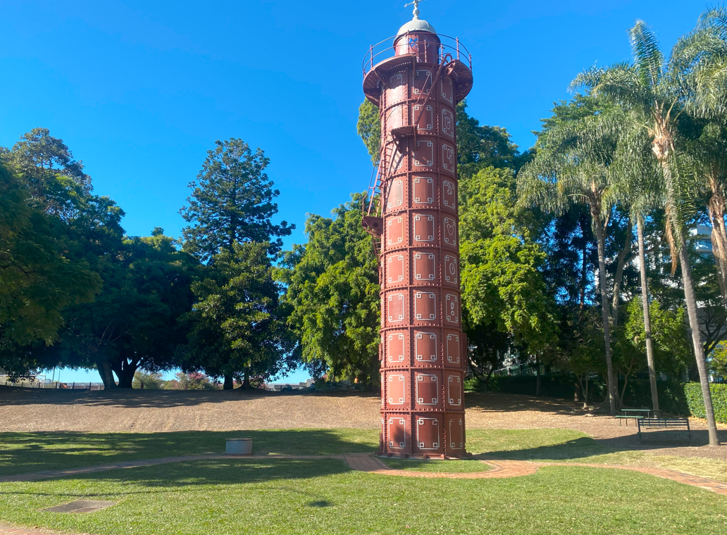
I picked up Riverside Drive for the pleasant final few kilometres back to Brisbane. The 1912 Gas Stripping Tower is a demountable cast iron tower manufactured in the Yorkshire town of Elland, and transported in segments to Brisbane, where it was erected at South Brisbane Gas & Light Company’s West End Gasworks in Montague Rd. Gas stripping was the removal of tar and ammonia from raw coal gas. They piped gas into the tower’s base, and it rose to the top via internal baffles. Water sprayed from a header tank at the top stripped the gas of coal tar and ammonia. A water seal at the bottom drained the stripped liquid which was sold as ammonia liquor. The tower was used until 1949 and the gasworks became defunct after the 1970s switch to natural gas. In 1975 the buildings were demolished except the tower. The Queensland National Trust acquired it and moved it 150m to its present location in Davies Park. It was refurbished in 1988 and was heritage listed in 1992 as the only one of its type in Australia.
I finished the 30km ride at the State Library of Queensland in the South Bank cultural precinct. The Brisbane Public Library was established in 1896 across the river in William St with a collection the Queensland government bought from bibliophile Supreme Court judge George Harding. Renamed as the Public Library of Queensland it opened to the public in 1902. In 1934 the Oxley Memorial Library was established as a centre for Queensland research and in 1971 the Public Library was renamed the State Library of Queensland. It moved from William St to South Bank in 1988. In the early 21st century the building was re-developed to double in size and re-opened in 2007. It has since been forced to close down twice for months following flooding in 2011 and again in 2022. Sadly my trip had a disappointing end. I locked my bike at the bike rack in the centre of this photo but when I emerged from the library 90 minutes later, my bike, lock and helmet were all gone. I hope that whoever stole it enjoyed the present I gave them on my birthday. But I’ll bounce back and get another one. I certainly won’t wait another 15 years before doing the wonderful Brisbane River loop again.

Happy Birthday!
Congratulations and many happy returns of the day!
Jan
Wiesbaden, Germany