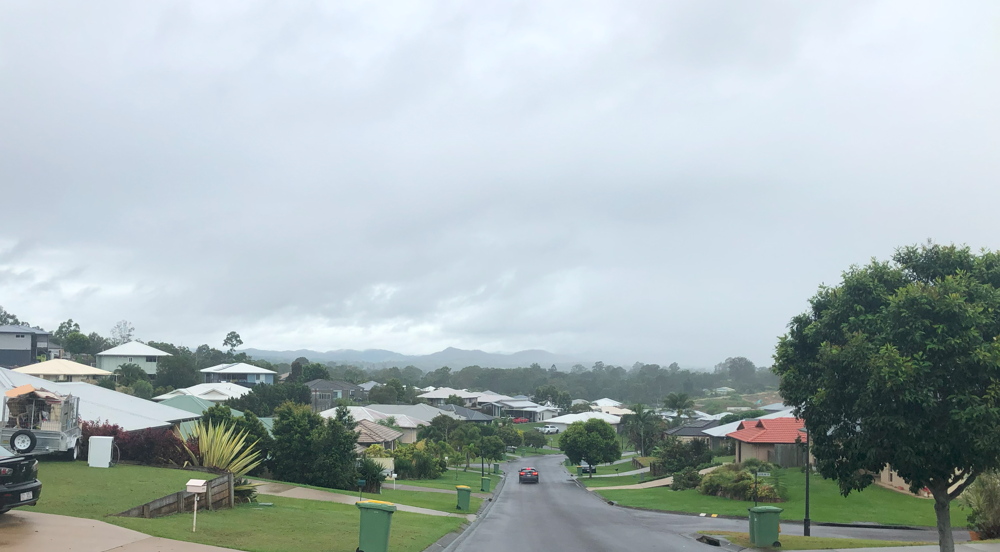
Another weekend, another round of parkrun tourism, or so I hoped. This weekend’s plan was to get the Brisbane suburban train all the way to the end of the line in Gympie, stay overnight, do the Victory Heights trail parkrun in the morning and get the bus home (the train timetables did not align for a return by rail). So after over three hours of slow rattling we got into Gympie North station around lunchtime Friday. The weather was overcast with rain forecasted, as I found my nearby Airbnb and walked 3km into town. I crossed fingers the parkrun would not be cancelled.
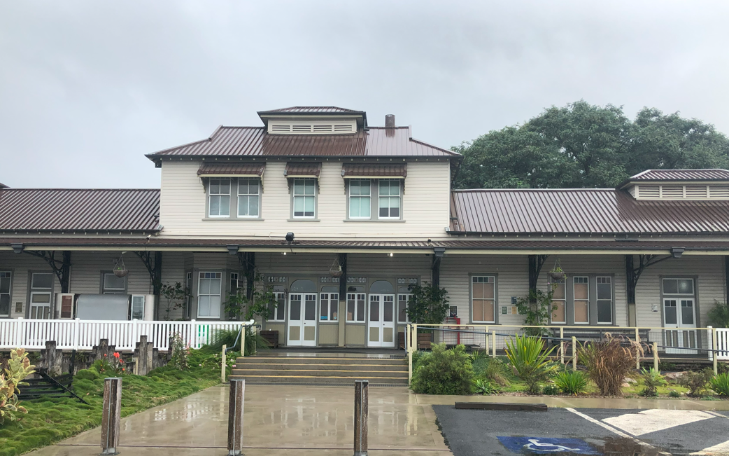
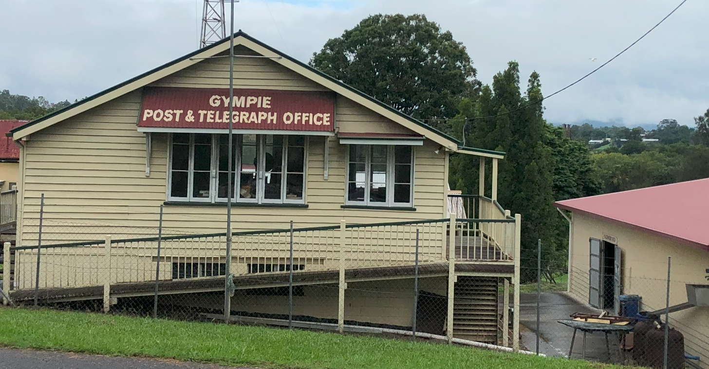
On the way, I passed Gympie station, which is prettier than the functional Gympie North and much closer to town, but is sadly no longer on the main line. A station first opened here in 1881 to connect Gympie’s goldfields with the port of Maryborough and within 10 years there was a connection to Brisbane. The current building, designed in Pagoda style with multiple layered eaves, dates to 1913 and is the largest timber railway station in Queensland. Gympie’s station became neglected with the rise of car travel and in 1989 Queensland Rail built Gympie North in an 8km diversion on the newly electrified Brisbane-Rockhampton route. Freight stopped coming through Gympie by 1995. The station got a new lease of life in 1998 when QR leased it to the Mary Valley Heritage Railway. The Valley Rattler steam train now plies the route to Amamoor.
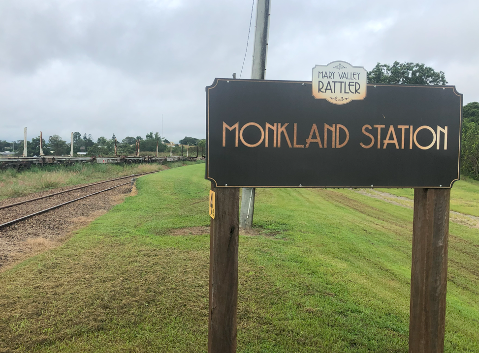
Gold was first found 4km south of Gympie in 1867 and Scottish prospector William Ferguson named the area Monkland for a locality west of Glasgow. By 1873, there were shops and four hotels to serve the goldrush and the railway station was added in 1889 on the Brisbane line. Like Gympie station, it was bypassed a century later though the Valley Rattler still trundles through.
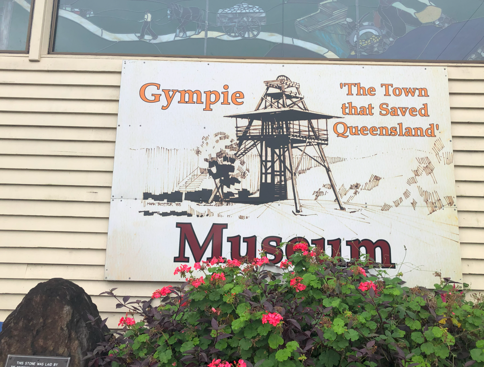
Goldrush memories are preserved in the nearby Gympie Gold Mining and Historical Museum. The tagline outside reads “the town that saved Queensland” and that’s not too much of an exaggeration. When Queensland left New South Wales in 1859, the parent colony took the treasury leaving the northerners broke. Unemployment was high, railway works had stopped, and the Bank of Queensland failed, leaving the new colony to survive in hand-to-mouth fashion. Then the Brisbane Courier announced in 1867 the discovery of gold at “Gympy Creek”. Prospectors poured into the region and found large deposits of gold. Within 12 months, Gympie had 30,000 people. Queensland’s unemployment problem vanished overnight.
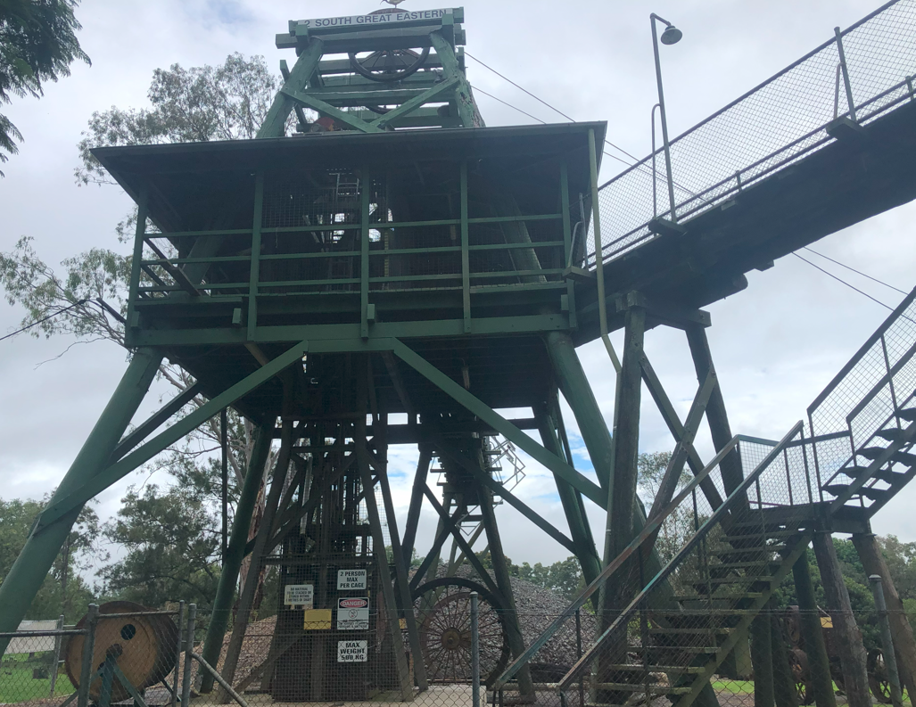
The Upper Mary River goldfield was officially proclaimed in 1867 in a 25 square mile radius. But the finds were so good, the radius was expanded to 120 square miles in 1877. By then the alluvial gold was exhausted. Shallow and deep reef mining commenced and by 1881 intensive gold mining marked a new era of wealth and prosperity. While payable gold ran out by the 1920s, there is still a fossicking area nearby. The museum’s No 2 South Great Eastern shaft is accessible via a reconstructed gantry. It contains an operational boiler house and steam powered winding engine, air compressor, generator and anciliary machinery.
The museum also features exhibits from the timber industry, dairy, agriculture, gems, transport, and military and social history including the relocated cottage of early Australian prime minister Andrew Fisher. Fisher, aged 10, came to Australia with his Scottish family during Queensland’s goldrush. He moved to Gympie in 1888, worked in the mines and was a trade unionist and Labor party activist. He help found the Gympie cooperative, and in 1891 became secretary of the Gympie Joint Labour Committee. He was elected to Queensland’s assembly as the member for Gympie before winning the seat of Wide Bay in the first federal election in 1901. He became Labor leader in 1905 and served three terms as prime minister in 1908-09, 1910-13 and 1914-15.
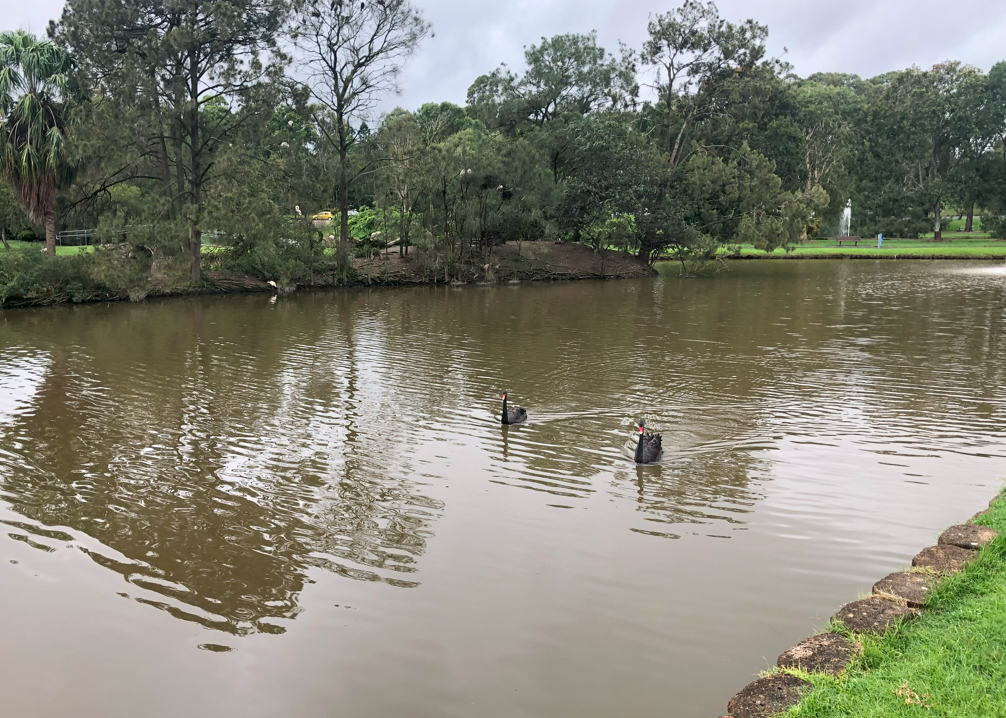
Near the museum is Lake Alford, an important bird sanctuary, named for neighbour Frank “Tiny” Alford (nicknamed in Australian fashion because he was very tall) who helped develop the park. This was a swampy area which Gympie Council drained and filled with water. The lake is home to numerous bird species. The signature black swans (Cygnus atratus) are completely black except for the red bill and white flight feathers on their wings while chicks are light grey.
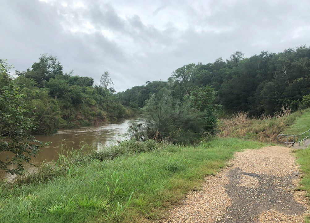
I wandered down a wet track to the Mary River. The river rises at Booroobin west of Landsborough and flows north through Gympie and Maryborough before emptying into the Great Sandy Strait near Fraser Island. The river was important to the Gubbi Gubbi people who called it “Moocooboola” (not to be confused with Mooloolaba which has a different root). The Gubbi Gubbi named a tributary creek for the gimpi-gimpi, the fearsome stinging tree found across the region. Europeans encroached onto Gubbi Gubbi lands in 1842 and found what they called the Wide Bay River. Five years later NSW governor Charles FitzRoy renamed it for his wife Mary. Settlers were attracted to the rich cedar which they threw into the river and exported to Sydney via Maryborough. After gold transformed the region, the Gubbi Gubbi were reduced by massacres and disease and were eventually forced into reservations at Fraser Island and Cherbourg.
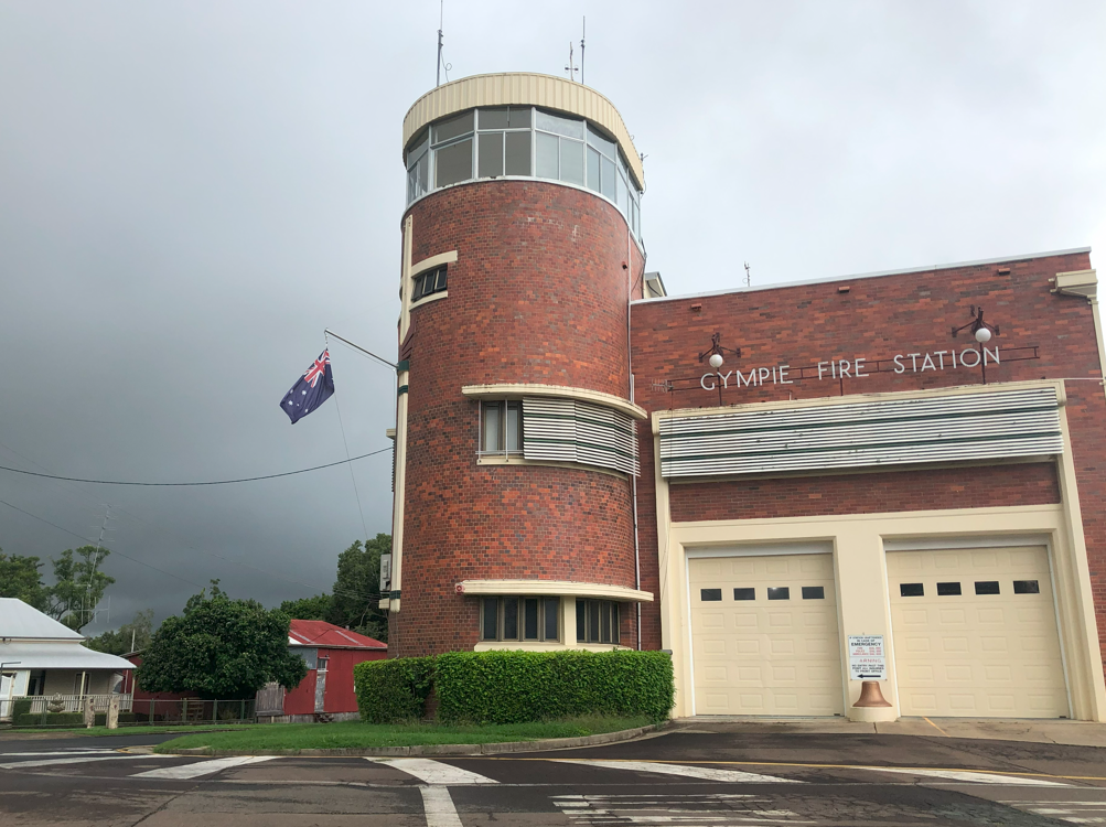
The first Gympie Volunteer Fire Brigade was formed in 1876 but lapsed before re-forming in 1901 with a fire station built in 1902. The current magnificent brick and concrete fire station dates to 1940. The station is believed to be haunted by the ghost of a fireman who died in a fall from the lookout on the tower in 1943. In 2023 the state government announced plans to build a new station south of town.
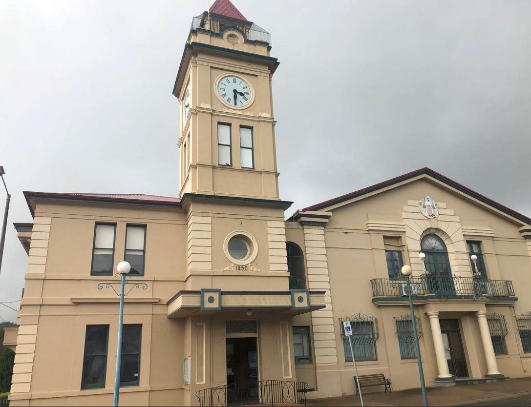
Gympie was gazetted as a town on January 26, 1880 and a reserve for a town hall was soon created. The original town hall and clock tower dates from 1890 and witnessed the creation of Gympie city in 1905. As gold production declined, Gympie transformed into an agricultural service centre. The building received a makeover in 1939 with a post office and reception hall added. It was heritage listed in 2011 for its original structure representing the importance of a highly profitable gold mining town and its 1930s extension reflecting Gympie’s evolution as the service town of an important dairy and agricultural district.
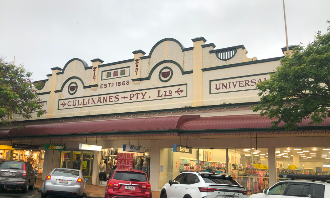
The town centre winds its way up from the river along flood-prone Mary Street. The Cullinane brothers started a drapery business in 1868, a year after the town was founded. They established a large presence on both sides of the street selling everything from dress material and accessories to china, linen and household goods. Gympie’s worst flood was in 1893 with a peak of 25.45 metres, inundating many businesses to the rooftops in lower Mary Street. On November 6, 1939 Cullinanes’ store burnt down with damage estimated at £60,000.
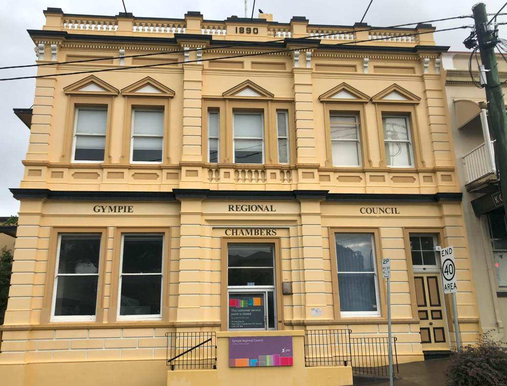
The influx of money and yield of gold was reflected in the redevelopment of upper Mary Street during the 1880s and 1890s. Derry-born architect Richard Gailey built the neo-classical Bank of New South Wales in 1890–1891 to replace a branch on the goldfields. In 1940 the bank sold the building to Widgee Shire Council which administered the rural area around Gympie. In 1993, Widgee amalgamated with the city of Gympie and the building became the Cooloola Shire Council Chambers. In 2008, Cooloola, Kilkivan and part of Tiaro were amalgamated into Gympie Regional Council. The building is now the Gympie Regional Council Chambers. It is heritage listed as “physical evidence of the evolution of Gympie gold mining, a major contributor to the wealth of Queensland”.
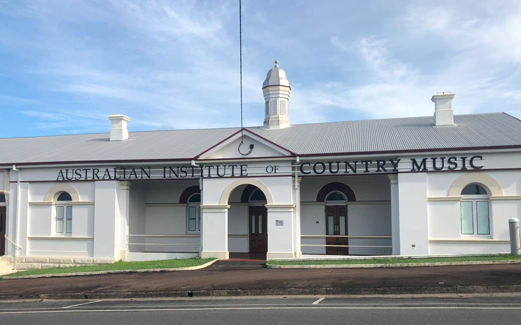
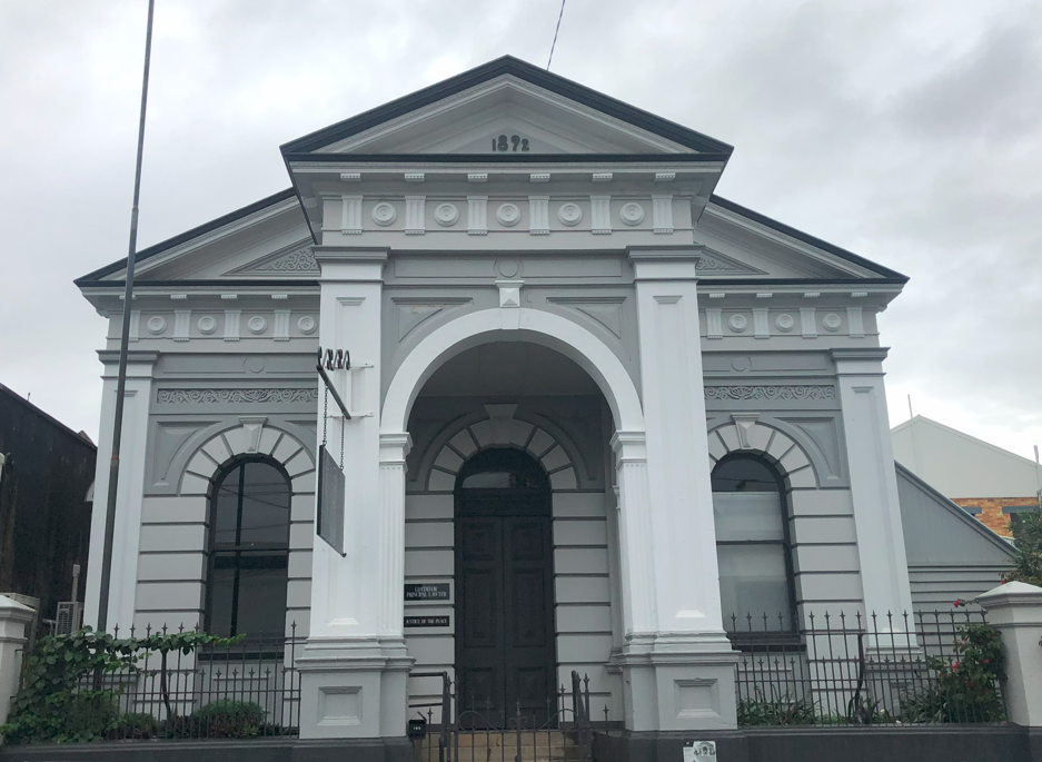
Around the corner on Channon St is the original courthouse and now home to the Australian Institute of Country Music. Irish-born Henry Edward King was appointed gold commissioner for Wide Bay in 1867 and conducted business on the Gympie goldfields until a Court of Petty Sessions was established in 1868. A new court was erected on Channon St in 1876 and it became the land office when the court house moved up the road in 1893. It continued to be used by state departments until 2002 when Cooloola Shire took it over and made the building available to the AICM.
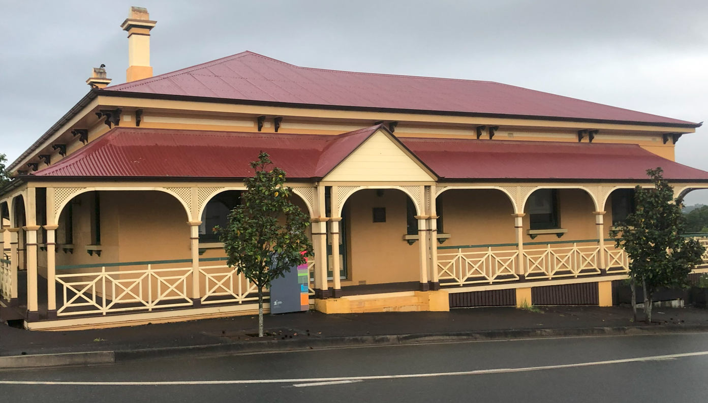
Across the road is the old bank building. The Queensland National Bank established a timber branch here in 1872, and enjoyed the gold bonanza, purchasing over 6000 ounces in its first three weeks. Three years later the current brick building was erected. When Gympie’s commercial centre moved to eastern Mary St the bank sold the building. It was used by industries until Widgee Council bought it in 1990. It is now used as council offices.
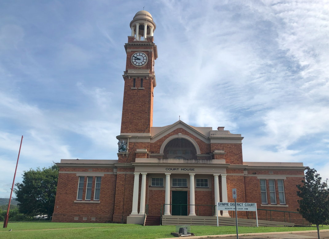
Further up Channon St is the new courthouse. In the 1890s local MP Andrew Fisher pushed for a larger replacement to the old courthouse. In 1900 colonial architect Alfred Barton Brady, who designed Brisbane’s old Victoria Bridge, selected the site and commissioned fellow architect John Smith Murdoch to design the building in Federation Free style. The building was designed to be seen from across town and the clock tower dominated the landscape. It has been heritage listed as a significant landmark with high quality design and workmanship.
Gympie’s third important colonial-era bank building is the Royal Bank of Queensland. A great fire in 1891 destroyed many timber buildings on Mary St and this neoclassical single-storey building was one of many permanent structures erected the following year. The Royal Bank was established to help Queensland farming and mining investors who could not get loans with other banks. In 1922 the Royal merged with the Bank of Northern Queensland to become the Bank of Queensland and then merged with the National Australia Bank in 1948. NAB closed this branch in 1979 and it became commercial premises, and offices for the Gympie Muster. It is heritage listed as a “good example of a masonry structure in a classical style”.
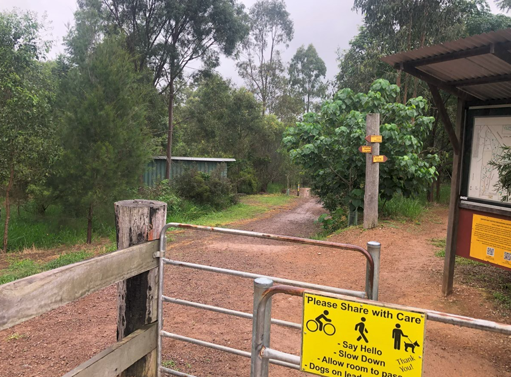
The following morning I went out to Victory Heights Trail Network, which comprises 60 hectares of eucalypt forest and 25km of mountain biking trails. It also hosts Gympie’s parkrun. While Saturday was perfect for running, the damage had already been done and Gympie Regional Council asked organisers to cancel it to give the course time to dry out. I sadly trudged the 3km back to town to get my bus home.
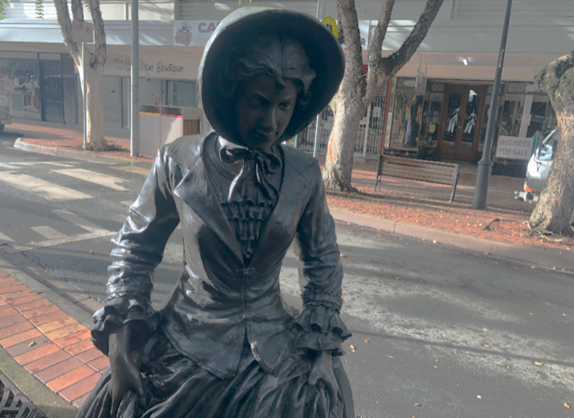
I had breakfast at a Mary Street cafe and admired the nearby “Lady of the Mary” statue. The statue honours British aristocrat Lady Mary Fitzroy, who moved to Australia when her husband Charles Fitzroy was made governor of NSW in 1846. In 1847 Fitzroy renamed the Wide Bay River and Maryborough in her honour. A few months later, Lady Mary was killed in a carriage accident in Sydney. The 2017 statue imagines her dipping her feet in the Mary river, which she never saw.
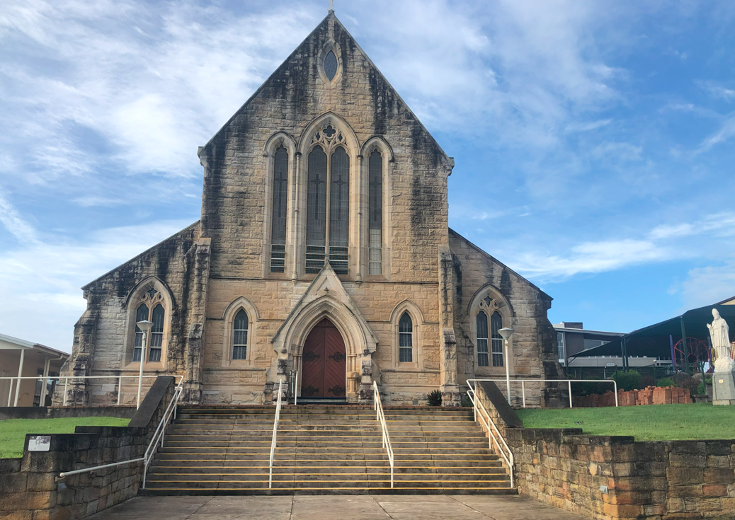
The parkrun cancellation gave me more walking time and I checked out St Patrick’s Church. Many Irish Catholics joined the Gympie gold rush and priests followed them, with the first Mass in the new town in 1868. Gympie’s early churches were basic affairs until the massive sandstone St Patrick’s was constructed on a prominent spot on Calton Hill in 1883. The architect was prolific Scottish-born government architect Francis Drummond Greville Stanley, who also built Brisbane’s GPO, Roma St station, Toowoomba’s courthouse and post office, and some of Charters Towers’ grand buildings. Queensland’s first Catholic archbishop Robert Dunne officially opened St Patrick’s in 1887. It is heritage listed as a good example of 1880s church architecture, “influenced by Gothic revival styles and of the ecclesiastical work of the prominent Queensland architect, FDG Stanley.”
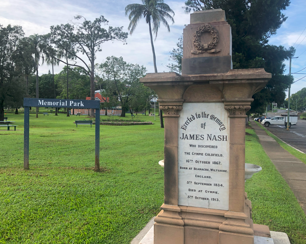
It is appropriate that a city associated with country music was once called Nashville. A Memorial Park monument celebrates Wiltshire-born James Nash “who discovered the Gympie Goldfield 16th October 1867.” Nash emigrated to Sydney aged 23 and became a labourer and NSW gold prospector. Nash moved to Calliope, Queensland in 1863 then to Nanango. He was attracted by the news of a £3000 government reward for a new gold field, and set off from Nanango to Gladstone. As he came down from Imbil, he thought the Mary River might be payable. Nash found quantities of gold and reported his findings in Maryborough. Within a month, the port town was full of excited prospectors “off to the diggings” at what was soon dubbed “Nashville, Gympie Creek”. However the miserly colonial government haggled with Nash before granting only £1000 after twelve months’ debate while the field quickly shed his name and became Gympie. Though Nash and his brother earned £7000 from their claims, they lost their winnings in poorly-performing mining stock and an ill-fated drapery store. The government finally helped the near penniless Nash in 1888 it made him the local powder-magazine keeper at £100 a year. He died in 1913 in Gympie, aged 79, suffering from bronchitis and asthma.
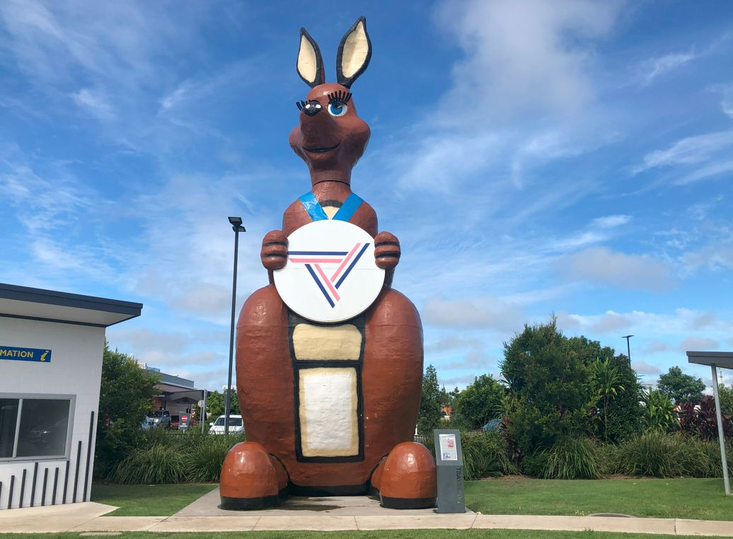
The bus back to Brisbane stopped at a service station in Traveston, 20 minutes south of town. In the car park was a glorious piece of 1980s Queensland kitsch. The 13-metre-tall Matilda was the kangaroo mascot for the 1982 Commonwealth Games in Brisbane. Matilda became a favourite when she was wheeled into the opening ceremony, turned her head, wiggled her ears and winked at the crowd. In 1984 Matilda was placed alongside the Pacific Highway at Wet N Wild, Oxenford. Matilda Fuel Services bought the namesake kangaroo in 2009 for their Tugun outlet but the massive marsupial breached Gold Coast planning regulations. The owners moved her to another travel centre at Kybong, 20km south of Gympie. Anticipating the Gympie bypass, the Traveston Service Centre was opened 5km away in 2020 and Matilda made the short hop south down the Bruce Hwy. She gave me a sly wink before sending me on my way home.